Thursday 27 February 2014

Managing congestion with the Oyster (aka Opal) Card

Bus routes from Victoria Road
Previous posts have dealt with how, for more than one hundred years, tram and bus services from the Eastern Suburbs and, in particular, the South Eastern Suburbs have been designed to minimize the number of buses that travel through the "pinch points" in Elizabeth Street northbound. Similar measures have been utilised to minimize congestion in George Street north of Market Street for buses from Victoria Street and the City West Link roads.

There are two basic routes for buses from Victoria as you can see above. One uses Druitt and George Streets to terminate at Alfred Street or north of Grosvenor Street; the other travels along Harris Street and gives direct access to the Parramatta and City Road bus services and Central Station as well as the southern half of the CBD. Buses terminate on this route by discharging the last of their passengers in front of the Town Hall, with hazard lights flashing, and doing a loop-the-loop round Druitt, Clarence, Market and York Streets. This requires an against-the-flow bus lane in Market Street:
This is not ideal, as the buses are competing for space to turn right in Druitt Street with North Shore buses terminating at the QVB, and there is no space to lay over. In the evenings the two routes are combined. I waited in vain at the stop in Druitt Street for a bus to Lilyfield in 1987, so these routes have been in operation for some time.

It has been the bus services from Parramatta Road and City Road that cause congestion in the bus lanes in George Street north of Market Street. Passengers transferring to trains at Central Station leave the bus at the last stop on Broadway and traipse through the Devonshire Street Tunnel to the platforms. Passengers disembark here also to catch the 378 service along Oxford Street. The buses discharge further passengers at Town Hall to transfer to New South Head Road services and are running on empty by the time they reach the terminus at Bridge Street - the only place in the CBD where they can physically turn around. The congestion in George Street is obviously not caused by hordes of passengers trying to get to Circular Quay by bus.

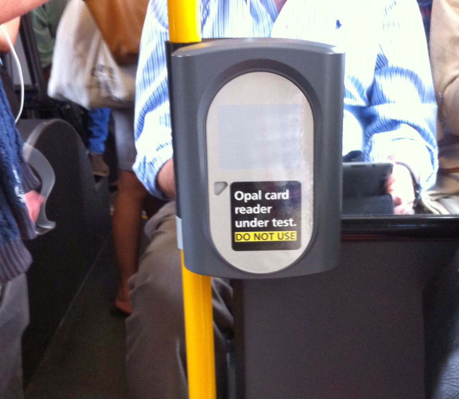
In the past it has not been possible to dissuade passengers from catching a bus to Circular Quay and getting off at Railway Square, so all bus routes along Broadway have gone on to the terminuses at Circular Quay. I pointed out in my letter to the Minister in April, and reiterated this in my submission to the EIS, that all this changed with the development of the Oyster (aka Opal) Card.
George Street at Town Hall
Here's how it works: there are services from City Road and Parramatta Road that terminate at Circular Quay as at present; services that turn right into Park Street from the Bus-Only lane in front of the Town Hall and terminate at the forecourt at the Domain car park; and services that pass along Pitt Street and Eddy Avenue to terminate at Randle Street. All these terminuses allow lay overs so buses can maintain schedules. Randle Street was successfully used as a terminus for the Olympics in 2000 and is used for events at the SCG.

Passengers can use the Opal Card to switch destinations at any stop in Parramatta Road or City Road regardless of the destination on the front of the bus when they boarded it on their local roads, and then continue their trip. Eastern Suburbs commuters have been doing this for generations. If passengers are still on a bus service beyond a certain point, say the bus stop on Broadway just to the east of the City Road, they pay to go to the terminus on the front of the bus regardless of where they get off. Only buses with passengers needing to go to destinations in the northern half of the CBD pass through the "pinch points" in George Street north of Market Street - problem solved. City Road services would not have a terminus at Randle Street as transfers to rail can be made at Newtown Station.

The tech guy at the "information session" commented about the system I have described: "The power of pricing". There is more going for it than that though. Services terminated at the Domain car park would give round-the-corner transfers to Eastern Suburbs bus services from a stop in Park Street at Hyde Park and services terminated at Randle Street would give access to Elizabeth Street bus services.

Running seven-segment trams along George Street obliterates not only all the places in the northern CBD where buses can physically turn around - terminuses north of Grosvenor Street and at Argyle Street as well as Alfred Street - but also at Randle Street. George Street bus services are simply displaced to Elizabeth Street. It will never ever be possible to resolve bus congestion in the CBD.
The reclusive Chris Lock
At the Randwick breakfast in April the Deputy Director General TfNSW, Chris Lock, bemoaned the queue of buses in York Street, trying to reach the Wynyard Park bus terminus, that he claimed could stretch to the other side of the Bridge at the morning peak. His only solution was to divert some buses across the Cahill Expressway. The Opal Card can minimise bus congestion here as well.

There would be three, at least, terminuses: Wynyard, York Street at the Queen Victoria Building, and Lee Street. You know the rest. The point at which a transfer to a bus with the proper destination would have had to have been made would presumably be the last stop in Military Road or Falcon Street. George Street in front of the Town Hall can never be "pedestrianised", but then, George Street has been the main traffic artery to western Sydney from the time of the first fleet.
Melbourne bus console
So how much would it cost to resolve bus congestion in the CBD? A hell of a lot less than spending, we are told, $1.6 billion on a tramway and making bus congestion intractable. In fact it would not cost a brass razoo more than has already been committed by the state government to roll out the Opal Card - more than a billion dollars.

In the old days, buses had rollers with destinations at the front and the drivers manually set the destination at a terminus. Now buses have LED signs that are set from the drivers console. The bus' route is clearly fed into the software for the Opal Card so dastardly commuters who switch from a different route can be differentiated from commuters who get back on a bus of the same route after stopping for coffee.

Passengers who fail to tap off with their Opal Card are charged for the whole route to the terminus, so charging passengers for trips based on the sections as published on route maps, as with the existing Mybus paper tickets, is already built into the software. It will be ridiculously easy for a future, competent state government to restore sanity to public transport.

The Oyster (aka Opal) Card system described above is the antithesis of the bizarre pricing system being rolled out by the O'Farrell government. It does not penalise commuters who change routes when making a journey in one direction.

Incredibly, the Opal Card being rolled out will penalise commuters who transfer from buses to the, we are told, $1.6 billion dollar South Eastern Suburbs light rail. This is a mode change and is regarded as a separate trip. The state government refuses to say what the pricing structure on the trams will be. This will evidently be decided by the PPP.

The extra costs for commuters who are forced or volunteer to transfer at the Randwick or Kingsford terminuses will pale to insignificance compared to those for commuters terminated at Rawson Place. No matter how bad off you are there is always someone worse off.

Tuesday 25 February 2014

The world is your Oyster (aka Opal) Card

For generations, public transport passengers in Bondi and Bronte have been switching destinations at Bondi Junction. The bus services take them to destinations in Elizabeth Street or to Railway Square to connect with Parramatta Road and City Road services. They can transfer to the Eastern Suburbs Railway for fast trips to Martin Place and Town Hall, and Wynyard and Circular Quay, and to the rest of the rail network - bus/rail from North Bondi to Martin Place takes 34 to 38 minutes whereas staying on the 333 bus takes 50 minutes, assuming there is no delay at the pinch points.

A Mybus 1 ticket will take you to Bondi Junction from North Bondi terminus and then a Mytrain ticket the rest of the journey. This not only saves passengers time it reduces the number of buses passing through the mother of all "pinch points" in Elizabeth Street northbound. The Mybus ticket structure was brought in specifically to simplify the ticketing across the public transport system as a precursor to the introduction of electronic ticketing.

The previous state government selected the Pearl Consortium (the Commonwealth Bank, Cubic Corporation and Downer EDI) as the preferred tenderer in April 2010. All the groundwork for a straightforward introduction of non-contact electronic ticketing had been done by the time the contract was signed a month after the state election. The public transport services to the Eastern Suburbs had evolved over two hundred years and the objective of minimizing bus traffic along Elizabeth Street northbound was the accepted imperative. What could go wrong?

O'Farrell publicly boasts that he will create congestion in bus routes in Elizabeth Street. TfNSW has pulled out all stops to gratify his objectives.

The SMH interviewed early-adopters at the North Bondi terminus who were using the Opal Card to get to Bondi Junction and they were unaware that they were paying almost twice as much as they would with a Mybus travelten ticket. This is hardly surprising as the only way to find out what a trip will cost you is to make a mental note of the balance on your account when you tap on at the front of the bus then use mental arithmetic to subtract the balance when you tap off. Unfortunately the Card readers on buses have vertical faces and are at waist height, as you can see - you have to crouch down to read the little window. The Readers beep at you like microwave ovens and washing machines so you don't need to see the windows.
The Opal Card readers installed at ticket barriers at train stations and on ferry wharves, and on ferries, have the windows in plain sight, as you can see, but this hardly matters as you know what you will be paying.

The sections for the Opal Card on bus routes are not based on established junctions and transfer stations such as Bondi Junction but are calculated on the distance as the crow flies between the stop where you tap on and the stop where you tap off. "For the first time, Sydney's buses will be fitted with automatic vehicle locating technology to calculate the straight line distance" between stops.

Opal Card fare bands
When the Opal Card was introduced on bus services to leafy Turramurra, TfNSW published the distances. The site now publishes details of unlikely trips where the Opal Card actually is cheaper. Contingency Law Firms will be salivating and sharpening their pencils at the thought of class actions against the state government, i.e. the NSW taxpayer. TfNSW publishes a disclaimer: "For some bus trips a customer's fare may move into a different fare band under Opal when compared to the 'sections' based paper ticket".

TfNSW claims an advantage of the Opal Card is passengers can alight at a stop, say Bondi Junction, for coffee and get back on another bus with the same route number within an hour and it just counts as the one trip. The vast savings with the Opal Card compared to single-trip Mybus tickets are detailed in a table:
These savings only accrue if you stay on a bus with the same route number. If you switch to a bus service with a different destination, or if you switch to another transport mode, say trains, this counts as a separate trip. TfNSW is giving strong economic incentives for passengers to stay on bus services headed inexorably for the "pinch point" in Elizabeth Street northbound.

Two hundred years of established public transport practice will have been overturned. Collateral damage to Eastern Suburbs public transport will be irreversible.

O'Farrell could not be more gratified.

Friday 21 February 2014

The murderous ploy of the wicked witch

Chalmers Street alignments
M20 route
Currently the Metrobus services from Coogee and Maroubra Junction (M50 and M40) and the bus services from the South Eastern Suburbs that terminate at Railway Square set down passengers at the Devonshire Street entrance to the Central Station platforms. The Metrobus service from Botany (M20), as shown in the route map left, does the same. Passengers wishing to transfer to a train service walk efficiently and completely safely to the appropriate platform.

As you can see from the alignment diagrams inadvertently released by Sydney Council there is no earthly reason why they could not continue to be set down here. The stop is to be obliterated (except when coupled juggernauts are operating at special events) to compel bus passengers to cross two tram rails in order to transfer to a train or a tram. This is nothing more than a ploy by the Wicked Witch of the North to dissuade public bus passengers terminated at Eddy Avenue from catching a train to Town Hall, Wynyard and Circular Quay. It is hoped that instead they will transfer to a privately-operated standing-room-only tram that travels at pedestrian speed to the same destinations.

This is surely a forlorn hope. Any bus passengers silly enough to succumb to this ploy will alight from their bus and look to see if a tram is approaching round the bend from Devonshire Street. If one is, they will make a frantic dash across the tracks to the opposite platform. Tragically, they would be unlikely to see a tram zipping round the corner from Eddy Avenue.

When Parramatta Road bus services are terminated at Coogee, along the old M50 route, this will be likely to occur more frequently.

Rawson Place stop
The Rawson Place stop is just as murderous. The President and Vice Chancellor of UNSW, Fred Hilmer, in his submission reported that their Facebook page alone had received several hundred positive comments or actions. The student body is composed of students who did not get the grades to go to a real university. Students and others needing to transfer from a 45 metre long tram to a bus service forcibly terminated at Rawson Place will alight from one of the five doors of the seven-segmented tram and wait for the rear of the tram to pass them, then cross to the northern platform to catch their bus. They will be focused on the buses pulling in or waiting at the stop. They will not see or hear the tram zipping round the corner from George Street.

O'Farrell has never shown any concern for the lives of people living south of the Harbour so it is probably worth pointing out that every time a tram hits someone or something or breaks down the CBD will be effectively shut down for an indefinite period.

It should be pointed out that O'Farrell and the Minister for Transport have been informed of tramway designs that do not pose the dangers to pedestrians and passengers that are inherent in this incompetently-designed tramway.

Thursday 20 February 2014

Dial M for Mindless obliteration

Technical Paper 1
Randwick and Coogee have the best public bus services in Sydney. People, including myself, had to make the effort to achieve this in the 1980s, and it is sad to see these services being utterly debased. Currently bus services in the Randwick retail centre that grew up along the nineteenth century tram routes in Belmore Road give direct access, without changing buses, to Bondi Junction, Sydney Airport, Rockdale (routes 400, 410); to Central Station and Railway Square (route 372); express to Bent Street in the CBD (route X73); all stops to Circular Quay via Oxford and Elizabeth Streets (routes 373, 377); to Central and then Circular Quay via Foveaux Street (route 376).

As well as these there is the M50 service direct to Drummoyne. Using the Oyster (aka Opal) Card one can switch destinations from a bus stop in Elizabeth Street, say south of Bathurst Street, to other Metrobus destinations - Chatswood via the freeway and Gore Hill via the Pacific Highway; and potentially other destinations. One can of course also switch to destinations further along Victoria Road.
M50 route
Public transport users in Randwick, and also in Coogee and northern Maroubra who may need to switch destinations in Belmore Road, can directly access every destination in the CBD and the major centres north of the Harbour. None of these services are anywhere near reaching capacity accept for the two services that pass through the mother of all "pinch points" in Elizabeth Street northbound.

The M50 and 372 services set down passengers at the entrance to the Devonshire Street entrance to the Central Station platforms and swift train services to Town Hall, Wynyard and Circular Quay Stations, and all the other stations in Rail network.

As can be seen in the diagram above from the Technical Papers in the EIS every one of the public transport services above, except for the express AM peak service to Bent Street, will be obliterated by a privately-operated tramway that only gives access to a trio of stops at Town Hall Station, Wynyard Station, a duo of stops at Circular Quay Station, and one other stop at China Town. The only buses passing though the Belmore Road retail strip will be buses that have been forcibly terminated at the triangular Highcross Park and forced to travel to Randwick Junction at the northern end of Belmore Road in order to physically turn round.
Mother of all right-hand turns
Go figure 8
The thing to note about the figures above of the Highcross Park interchange: only one of the rails will be in use in the morning and evening peaks, with the crossover occurring just before the Avoca Road intersection. But buses need to make return journeys at all times of the day! As we shall see, the number of buses in High Street will be horrendous at all times of the day.

Booz & Company assert disingenuously in the Technical Papers: "Metrobus routes M10 and M50 are not proposed to operate in the Eastern Suburbs as their function is largely undertaken by the CSELR." In fact, the raison d'etre for the Metrobus services was to provide extra services that did not send buses through the "pinch points" in Elizabeth and George Streets north of Market Street. A tram service that dumps passengers at Central Station and carries on empty to Circular Quay is the antithesis of these services.

TfNSW is obliterating the M50 service to Victoria Road, Drummoyne because it desperately needs the route for another purpose. Buses using this route along High Street, Anzac Parade, Cleveland Street and Chalmers Street will not continue along Elizabeth Street, they will be turned into Eddy Avenue and the newly created "pinch point" in Pitt Street. TfNSW will be terminating Parramatta Road bus services displaced from George Street at Coogee Beach rather than Phillip Street, Circular Quay. It is a binary choice: force displaced buses through the mother of all "pinch points" in Elizabeth Street northbound; or though the newly created congestion in Cleveland Street, Anzac Parade at the Carlton Street tram stop, and High Street.

Commuters in Coogee will also have a binary choice:

  1. Catch a bus that goes to Central Station and transfer to a train to Town Hall, Wynyard and Circular Quay.
  2. Transfer to a privately-operated cattle car that takes them to the same destinations plus one more, China Town. It is just a short walk from an Eddy Avenue bus stop to China Town!
Needless to say, TfNSW will be eliminating bus stops along High Street and other Randwick bus routes, making the stops 800 metres to 1 km apart, so the buses will be as inconvenient as the privately-operated trams. But bus stops can be easily restored by electing a state government and local councils that do not have an ideological imperative to force commuters from Public Transport onto privately-owned transport.

If this ridiculous project is approved the voters of Randwich an Coogee will have the job ahead of them, like the boy with the wheel barrow. Cleansing the Randwick stables will be a Herculean task but it has to be done.

Saturday 15 February 2014

Just "The Thing"

Replica of The Thing
The first patents for passive radio frequency transponders were taken out in 1973 although the principal had been demonstrated in a bugging device in a carving given to the US Ambassador to Moscow in 1945. It was called The Thing by the CIA when discovered by chance in 1952, and it was Peter Wright from MI5 who figured out how it worked. He later published a book in Australia, The Spy Catcher, and was unsuccessfully prosecuted in Sydney by the British Government. Several companies worked on devices, which came into widespread use when the original patent expired in 1990.

The Carr government planned to have the electronic ticket readers in operation before the Olympics, so they would have predated the first application of remote toll collection - the EIS for the M7 Western Link was in January 2010 and it was not given approval, with modifications, until a year later. The company that got the contract, the Perth-based company ERG, was unable to fulfill the contract which was eventually cancelled.
Oyster (aka Opal) Card Reader
In August 2008 the NSW government asked for expressions of interest for a second attempt to install contactless smartcard technology, and a new contract was awarded in April 2010 based on the Oyster Card used by London Transport. Now it appears the O'Farrell government is stuffing up its introduction: http://www.smh.com.au/nsw/more-take-a-shine-to-opal-smartcard-despite-fare-flaws-20140214-32r1w.html

This is really unfortunate because the technology can resolve congestion in bus routes in the CBD and ultimately save Public Transport users in Sydney tens of billions of dollars.

The article in the SMH by Jacob Saulwick refers to only roughly one in ten passengers boarding the 333 bus service using the Opal Card. Some commuters have discovered that from Campbell Parade in Bondi, a trip to Bondi Junction costs $3.50 using an Opal Card but a single trip using a TravelTen card costs $1.80. One stop closer to Bondi Junction from the terminus, the Opal price drops to $2.10. If you fail to tap off when alighting there can be a $5 penalty.

In the terminology of TfNSW's multi-million dollar signage the 333 service from Circular Quay to North Bondi is a "B" route and the sections are based on distance and not related to the Eastern Suburbs "T" service - unlike the TravelTen system brought in by competent state governments before O'Farrell. But before O'Farrell travellers did not know if they were getting onto a train, a bus or a ferry!

Ironically, I mentioned my experience with the Oyster Card in London in my letter to the Minister of Transport in April when expounding on what the tech guy at the "information session" would describe as "the power of pricing". London Transport has large concentric zones round the City of London. I had a weekly two-zone Oyster Card; the boundary between zone two and three passed midway through the main Olympic Stadium. I thought I could travel to the light rail station on the boundary then get a day ticket to travel the one extra stop to the Westfield Plaza, the closest you could get to the Olympic Complex - the largest British troop encampment outside of Afghanistan. Impossible; I had to buy two three-zone day tickets, costing more than four pounds in each direction.

Clearly my entreaties to the Minister have not had any effect, other than to turn the Deputy Director General TfNSW, Chris (Grid) Lock, into a recluse. I reiterated the arguments I put in my letter to the Minister in my submission to the EIS. It is now up to the assessment process.

I have written to Ministers only three times in my life and have made submissions to three Environmental Impact Statements. The arguments put have generally been acknowledged even if obliquely. But now we are dealing with bureaux set up and staffed by O'Farrell.

I will expound in this blog on the arguments in my submission.

Thursday 13 February 2014

The power of pricing

The EIS for the Eastern Distributor left me deeply shocked - how could something so straightforward go so terribly wrong. All the objections I and others raised were upheld during the assessment process, so sanity prevailed in the end, but I resolved to look over other EISs in future.

The EIS for the Westlink M7 Motorway showed it extending from south of Liverpool all the way north to link up with the old freeway reserve south of Old Windsor Road. I pointed out that the toll booths for the Western M4 Motorway had been place to the east of Parramatta: "No power in the known universe can prevent motorists transferring to the Western M2 Motorway, travelling to the Prospect Highway for free and reaching the M2 Motorway in half the time".

I proposed that the cost of the project could be halved by having the Motorway make a bee-line to the Prospect Highway - to the east of Prospect Reservoir. The project went ahead as planned, but the toll for vehicles entering from south of the M4 is the same if they exit at the M4 or if they exit at the M2 - travel for the second half of the journey is for free. This was not presaged in the EIS.
Little prospect for completion of Prospect Highway
I had not taken into account the power of Radio Frequency IDentification (IFID) which had not yet been introduced into NSW. Vehicles can be identified when they enter a motorway and when they leave. There is no need for toll booths - customers have to open an account.

The missing link between Blacktown Road and the Prospect Highway has never been completed, which would be a contributing factor, however the Westlink motorway is one of the few PPPs that has not gone into receivership, so clearly the strategy has worked to some extent.

I was discussing the role of another application of the technology in reducing bus congestion in the CBD with the tech guy at the final "information session" for the CSELR EIS and he commented: "The power of pricing". In fact the only feasible strategy for controlling congestion in bus routes is this late twentieth century technology. A nineteeth century tramway makes congestion in the CBD intractable.

As a footnote, on page 140 of the mammoth 424 brochure, NSW Transport Masterplan final, it is stated: "An analysis of the options ... suggests that introduction of distance-base tolling on the Sydney motorway network offers the most benefits to NSW. It will encourage greater network efficiency by sending a consistent price signal to road users and has been used successfully around the world, including here on the M7".

It beggars belief that the Public Servants who churn out these brochures for the government could have no recollection of the compromises and decisions that were made to bring the City's existing infrastructure into being.

One thing that can be deduced for certain from this page is that tolls will be reintroduced on the M4 and introduced on the M5, so that residents of Western Sydney will bear the brunt of paying for infrastructure that is of little advantage to them and mainly benefits trucking companies who choose to bypass the truck/rail transfer station.
Transport Masterplan p142


Tuesday 11 February 2014

Curiouser and Nastier

CBD bus network
The 12/12/2013 brochure restored the Young Street loop to the last remaining bus terminus in the CBD, but what of the all-new terminus in Walsh Bay. This has remained a line on a map in all the iterations of the figure. Information on how buses will physically turn around here is subject to commercial confidentiality. Buses have never turned around here in all the past.

When Sydney was a working harbour, one of the best deep water ports in the world, Walsh Bay had the main wharves. Now Pier One is an unsuccessful tourist attraction, another pier was converted to theatres for the Sydney Theatre Company and the remaining piers have been flogged off for residential - not exactly a hive of activity at which you would want your bus service to be terminated.

The other question is: which bus services does TfNSW intend to terminate at Walsh Bay? There is no Government Information made available on this matter. One must use deduction to work out the O'Farrell government's intentions.

Sydney's new bus terminus - Walsh Bay
Boundary Street overpass
Old tram routes to Eastern Suburbs
The last of the major tram routes to the Eastern Suburbs opened in 1908. It went from the Phillip Street loop to Bellevue Hill and soon extented to North Bondi. The hilly terrain of the Eastern Suburbs presented challenges which were met with the overpass, for trams only, over Boundary Street just east of St Vincent's Hospital. The Five Ways shopping hub in Paddington developed along the tramway, as also happened in Randwick and Kingsford.

When the trams were removed in 1960, the bus route that replaced them, the 387, followed much the same route. Buses from this route and from New South Head Road routes turned into Elizabeth Street from Park Street to reach the Phillip Street terminus. For more than a hundred years, Phillip Street has been the terminus for the public transport serving the Eastern Suburbs.

The North Shore rump of the Liberal Party has apparently decided that they will tell public bus passengers from the Eastern suburbs where they will go, and residents will have no say in the matter. The only warning is a trademark cryptic euphemism in the 9/11/2012 brochure:
"Some of the key changes that will benefit customers include:
  • Turning movements will be substantially reduced at the Elizabeth Street and Park Street intersection. This will help simplify bus movements through the city centre.
  • New bus routes will run to Barangaroo and Walsh Bay via the city centre and midtown interchange precinct."
Park Street/Elizabeth Street intersection

SMH 16th July 1923 p15

Criterion Theatre, corner Park and Pitt Streets
In the early settlement, ox-drawn drays found it hard to climb the Darlinghurst escarpment so the main route to the east was Oxford Street and Old South Head Road. The east-west roads between this escarpment and Darling Harbour, which extended south to Pier Street, were narrow and there was little reason to widen them. Sydney Council was given the power to resume properties for road widening in 1912 and proposals to widen Park Street went before Council in January 1914, to no avail.

Bradfield made personal representations to Council in July 1923 and the proposal to widen Park Street to one hundred feet was passed. It took some time for the widening to take place.

The Criterion Theatre was opened in 1886 and would have to be demolished along with the hotel. The building on the northern corner is now a Maccas restaurant. The last performance was on 13th July 1935. Sydney's two other Edwardian live theatres would survive until the 1970s.

Before the opening of the Cahill Expressway, York Street and Park Street was the main route between Australia north of Kirrabilli, and the Eastern Suburbs. The connection between York Street and Park Street was closed to vehicles other than buses by competent State Governments a long time ago forcing traffic onto the Cahill Expressway; and westbound traffic in Druitt Street was reduced from three lanes to two with the introduction of a bus only eastbound lane. Druitt Street is one of the most congested roads in the State.
Druitt Street was not widened in the 1930s - there was no reason to do this. The Robin Askin government had plans to introduce eastbound lanes in Druitt Street by demolishing properties on the northern side but the election of Neville Wran in 1976 brought these plans to a halt. The easternmost pylon for the carriageway over Darling Harbour had already been poured but this was cut off at the base and hauled away.

When a bus enters Druitt Street there are only two options:

  1. Proceed to Victoria Road - it is physically impossible to turn around.
  2. Make a right-hand turn from the westbound general traffic lane; which leads inexorably to the Harbour Bridge or Walsh Bay.
So instead of turning from Park Street into Elizabeth Street, as they have for more than 100 years, public transport services from the Eastern Suburbs are to be be caught up in general traffic lanes in Park and Druitt Streets; and will have to compete with North Shore buses terminated at the Queen Victoria Building, to make a right-hand turn from a two lane road.

Public transport passengers from the Eastern Suburbs are to be forced to walk south along Elizabeth Street to catch a northbound Broadway bus service or North Shore bus service, from a stop south of Bathurst Street, to reach destinations in the CBD north of Park Street.

The arrogance and incompetence of the Public Servants at TfNSW has reached a level that brings their sanity into question.

The fate of Eastern Suburbs public transport services will ultimately be decided at the State Election on March 28, 2015. If O'Farrell is returned for a second term all is lost.

Friday 7 February 2014

Spot the difference

 
The children's pages in newspapers have puzzles where you are asked to spot differences in adjacent drawings. Given the penchant of TfNSW for infantile argumentation it is not surprising that they should produce an outstanding example of the genera.

The diagrams above are from the SCCAS brochure (9/11 2013), the EIS and the Sydney's Bus Future brochure (12/12 2013), in chronological order. The EIS diagram is the only one that does not have an arrow down Chalmers Street, against the flow. The Bus Future diagram has an arrow against the flow in Foveaux Street as well.

The most bizarre feature of the diagrams is the Phillip Street terminus - the only place in the CBD where buses can physically turn around, not obliterated by the George Street trams. The line simply stops at Alfred Street. Buses were expected, it appears, to back south along Phillip Street until they can back into Bridge Street and continue along Phillip Street driving forward. This was not corrected until 12/12/2013 when the Young Street loop was restored.

The O'Farrell government had very good reasons for being systemically deceptive about this bus terminus as we shall reveal.
Phillip Street at Bridge Street - Street view
Phillip Street/Bridge Street intersection
Phillip Street is four lanes wide north of Bent Street as it passes the state government's Governor Macquarie and Governor Phillip office towers - it can never be widened. The parking under the Governor Phillip tower is accessed from a closed off Young Street. There are no vehicular destinations accessible from a right-hand turn from Phillip Street into Bridge Street other than the Cahill Expressway northbound. You can confirm this by dropping the little Street View figure in Bridge Street and scanning the facades of the Intercontinental Hotel and the Chief Secretary's Building.
Phillip/Bent Street intersection
Phillip Street northbound has three lanes south of Bent Street so right-turning traffic does not obstruct the bus lanes and can be used by all traffic originating south of Bent Street. So the sole purpose of the right-hand turn from Phillip Street into Bridge Street is to give the chauffeurs of the limousines of the Premier and his Cabinet, and the fat-cat Public Servants of the Premier's Department who park all day in the cavernous car park beneath the Governor Macquarie tower, the choice of using the Cahill Expressway to return home to the North Shore rather than turning left and using Grosvenor Street to reach the Harbour Bridge.

Traffic turning right at this intersection is extraordinarily disruptive to the Eastern Suburbs bus services.


The satellite snapshots of Google Earth are taken during holidays and the snapshot above shows two buses in the middle lane, which would be the preferred lane as it allows buses to leapfrog buses laying over in Phillip Street. When the Premier's chauffeur, or any other vehicle that chooses to take advantage of the Premier's special right-hand turn, is waiting for a gap in the southbound traffic in Phillip Street to make the turn, this lane is blocked. Buses are forced to use the kerbside lane, provided the driver put on his flicker soon enough, or wasn't followed by a straight-through vehicle that blocked the view of the rear lights. The taxi in the photo above has his flicker on - woe betide the vehicles behind him.

The Phillip Street/Young Street terminus operates with clockwise and anti-clockwise bus movements. Traffic turning right prevents buses entering the terminus two-by-two. The survival of this right-hand turn is testament to the arrogance and bloody-mindedness of fat-cat NSW Public Servants.

Now the Premier gets really nasty

The 13/12/2012 brochure announced that 60 buses from the Harbour Bridge had been diverted onto the Cahill Expressway in the mornings and would terminate at Bridge Street. This was reiterated by Chris Lock at the Randwick breakfast in April before he became a recluse. A year later, the 12/12/2013 brochure repeats the claim despite the trip finder and the information booths being unable to find these buses - I have given up looking for them. Now bus services from the North Shore diverted to the Cahill Expressway will not terminate at Bridge Street; they will "operate via Bridge Street, Castlereagh Street southbound and Elizabeth Street northbound".

All the figures above show the route. Now bus drivers on Eastern Suburbs routes will not only have to cope with Public Servant's limousines, and taxis, waiting for a gap in the southbound traffic to turn right they will have bendy buses from the North Shore Suburbs waiting for a gap!

Buses from the electorates of the Cabinet Ministers will not only congest the mother of all "pinch points" in Elizabeth Street northbound they will destroy the efficacy of the only remaining bus terminus in the CBD.

O'Farrell's resentment against residents of the Eastern Suburbs and his ideological antipathy to public transport knows no bounds. The attack on the Eastern Suburbs public transport gets even nastier as this blog shall disclose.

Tuesday 4 February 2014

Imagine, Chinese New Year every day, all day

Year of the tablet
Sponsored float
When I first came to Sydney we used to stand on cars foolishly parked in Flinders Street to watch the Gay Mardi Gras parade, which rolled relentlessly over organised opposition. Now Sydney hosts some of the largest night-time parades in the world, and they are big business for the state. The internally illuminated floats carried the sponsors name in the panel behind the cute inflated figures.

As pointed out in a previous post the Chinese New Year Parade provides a chilling demonstration of what will happen every day, for most of the day, if George Street is pedestrianised. I had been caught in traffic banked back to Sydney University after 5pm in a previous year and was delayed for about an hour, so this year took photos. It was 7:30pm and the traffic jam had started to clear.
Grid lock in Pitt Street, 7:30pm
Broadway at Harris Street
Buses going nowhere 
It will be worse - George Street closed


The road closures for the Chinese New Year parade give, in fact, a good prediction of what will happen if George Street is pedestrianised. There were two additional closures that ensure that the congestion every day of the week will be much worse than on Sunday evening.

In the Technical Paper 1 5.5.3.4 Booz & Company waft on: "Traffic accessing the CBD from Parramatta Road/Broadway is likely to divert to Wattle Street ...". All these routes remained open but almost no traffic was turning from Broadway into Wattle Street on Sunday night. As pointed out in a previous blog the preferred routes to Darling Harbour and Barrangaroo will be George to Hay Street and Pitt to Liverpool Street - both these routes were closed.

All routes to the Cross City Tunnel remained unaffected, as did the route along King Street. Buses were rerouted to Elizabeth Street, as they will be when Bra Boys take over George Street, and were caught in the slow crawl to Pitt Street, but on Sunday they did not have to cope with bus stops in the Pitt Street "pinch point" between Christ Church of St Laurence and Central colonnade, or the tram lines.

So Sunday evening was a full dress rehearsal for what bus passengers using Parramatta Road and City Road services will face every day from early morning to 8pm - apart from the extra traffic going to Darling Harbour and Barrangaroo. Buses being forcibly terminated at Rawson Place will be caught in the same maelstrom as buses inflicting collateral damage on Elizabeth Street bus services. This is every day of the week including, of course, Sundays, for the rest of the life of the City.
Who's the bunny