Thursday 27 August 2015

The Off-Broadway review

Broadway bus services after 4 October
When the Castlereagh/Pitt Streets tram loop was inexplicably torn up along with the tram rails in George and Elizabeth Street, bus services from City Road took over the route, operating in reverse direction. The Pitt Street Mall required the city-bound route to be relocated: George Street was less congested than Elizabeth Street and there was more space for buses to lay over at Circular Quay.

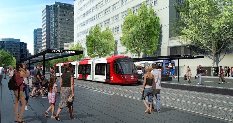
From 4 October 2015 Parramatta Road and City Road bus services will be forcibly terminated at Hay Street or Hunter Street. Buses forcibly terminated at Hunter Street will now have to pass through the mother-of-all pinch points in Elizabeth Street northbound. For generations traffic planners had meticulously avoided this.

Regardless of whether buses are forcibly terminated at Hay or Hunter Street every bus from Broadway must inexorably:

  • pass through the intersection of Pitt Street and Eddy Avenue, inbound and outbound;
  • cross four tram-rails, inbound and outbound;
  • cross their out-bound route three times when on the in-bound route and vise versa;
  • set out on the return journey immediately after turning round.
October 4, 2015 is the last time in the life of Sydney that a Parramatta Road or City Road bus will run on schedule.

The Dénouement

Shortly before he became a total recluse Chris Lock told the Randwick "businessmen's" breakfast: "The light rail of itself  will take 220 buses out of the CBD".

He was reiterating the phrase that had appeared in the brochure Sydney's light rail future. The claim was chanted again in the EIS and was quoted in countless news stories in the Murdoch and Fairfax press and in radio and TV bulletins.

The Secretary who wrote the Final Secretary's Report  for the Department of Planning and Environment also stated baldly "The proposal would result in 220 fewer peak hour buses into the Sydney CBD".

All attempts to find out what was meant by "take 220 buses out of the CBD" including written requests from PUSH shortly after the Community Forum were thwarted by TfNSW. Chillingly, the consultants SAMSA Consulting commissioned by the Assessors at the Department of Planning & Environment to make an independant Peer Review of Traffic and Transport Assessment were not given any information as to what was meant.

The only bus services taken out of the CBD north of Market Street which is where congestion occurs by the light rail of itself  are the Flinders Street bus services through Kingsford and Randwick, not including the Metro routes. These can be tallied from the time tables and are a lot less than 220 in the peak hour.

SAMSA Consulting took the figures seriously and in Section 3.2.4 queried the claims about the capacity of the system. The derisive response of TfNSW was incomprehensible but they concluded by asserting: "Detailed demand and operational modelling has confirmed that the capacity of the CSELR is appropriate". ALSTOM later demanded that the vehicles be increased in length from 45 metres to 67 metres in order to meet day-one demand.

On 17 July 2015 TfNSW issued a series of media releases the finally revealed the modelling used to produce the outrageous claims they had been chanting for 3 years. The media releases redefined the meaning of CBD: "The core of the CBD is bounded by Bridge Street to the north, Elizabeth Street to the east, Liverpool Street to the south and Clarence Street to the west".

Using this definition of "CBD" buses looping along Bridge Street are "removed from the CBD". Broadway bus services that are forcibly terminated at Campbell Street are "removed from the CBD" while those that are forcibly terminated at Hunter Street are not. The modelling used by TfNSW can remove an arbitrary number of "buses from the CBD" by simply declaring where bus routes will be terminated.

The modelling used to justify and promote the tram project was so infantile, so deceptive, so presumptuous and so destructive to public transport south of the Harbour as to be beyond belief.

We know that SAMSA Consulting and apparently the anonymous Assessors at the Department of Planning and Infrastructure were not informed as to the modelling being used by TfNSW but the question remains as to whether the senior public servants put in control of the Department by Pru Goward were as incompetent and corrupted as the public servants in control of TfNSW.

The question arises: why Campbell Street?

Don't you just hate it when dénouements give rise to more questions than they answer.

Campbell Street will be the most southerly east to west crossing of the "Berlin Wall" when Rawson Place is closed to vehicular traffic. It leads inexorably to Liverpool Street but movements can take place while trams are crossing Liverpool Street so it will be heavily used for east-west traffic. Druitt Street and Market Street are the only other places where Eastern Suburbs' traffic can cross into the western CBD.

Pitt Street is two-way south of Goulburn Street and TfNSW concedes that it will remain two-way. The reason it must be two-way is dictated by the width of Goulburn Street west of George Street - just two lanes each way. There is no lane for vehicles to turn into George Street. There is no right-hand turn into Elizabeth Street either.

Right-hand turns in Goulburn Street
To reach the southern arterial roads, Elizabeth Street and Botany Road, vehicles must turn into Pitt or Castlereagh Streets and percolate east along Campbell or Hay Street to Elizabeth Street. These roads will carry heavy traffic loadings if the traditional arterial road Rawson Place is closed.
Intersection of Hay and Pitt Streets
In order to physically turn around bus drivers terminated "nearside" must turn across this traffic from a two lane road into a two-lane Campbell Street eastbound and make a further right-hand into Castlereagh Street. Bus drivers terminated at Hunter Street are no much better off, having to turn into Hay Street from Pitt Street. The question remains: Why?

The pedestrianisation of George Street makes the section of Park Street eastbound between Pitt and Castlereagh Streets a bus-only road. The only way a vehicle can reach here is from Pitt Street. This is purely a rat run for motorists trying to avoid crippling congestion in Eddy Avenue and Elizabeth Street south of Park Street. Private vehicles would presumably be proscribed from turning here and forced to join the queue of vehicles dog-legging from Bathust Street to William Street.

Park Street from Pitt to Castlereagh Streets
Buses looping here would not disrupt east-bound buses and would use a right-hand turn into Castlereagh Street used by Metro buses.

Allowing buses forcibly terminated at Hunter Street to turn into Eddy Avenue would give passengers a stop adjacent to Central Electric and solve the problem of turning into Hay Street.

So why is Baird wilfully and unnecessarily inflicting so much inconvenience and damage to the bus commuters of the inner west?

There is only one explanation. Baird's ideological imperative is to destroy the efficacy of the Public Transport system so as to force passengers onto a privately-operated tram consortium.

This was discussed in a post Tripping the Light Rail fantastic 1 March 2014. To get from say Sydney University or anywhere in the inner west to say Dover Heights or anywhere along New South Head Road passengers are expected to catch a bus to Belmore Park, a cattle car to Town Hall, a Walsh Bay bus or an Eastern Suburbs train to Edgecliff Station then transfer to another bus service - an expensive four separate trips.
Media release 17 July 2015
Physically turning round buses not destined to pass through the mother-of-all pinch points in Elizabeth Street at Park Street would take the privately-owned cattle cars out of the equation. Oh no!

Go back from whence you came

SBS, please teach invaders correct English
Rawson Place has been the main arterial between Sydney docks at Darling Harbour and the southern arterial roads from the earliest days of the colony. A post Last Exit from Barangaroo (expurgated version) 17 October 2013 discussed the dire consequences of its closure to vehicular traffic. When the Hungry Mile had been the chief docks for NSW the connection between Sussex Street and George Street at Hay Street was the main exit from the docks. When Hay Street became one-way to install tram rails traffic from Sussex Street continued further south and could reach Rawson Place from Ultimo Road

Ultimo Road disconnection
The EIS maintained the connection of Ultimo Road and George Street south-bound although this was of dubious benefit with the closure of Rawson Place. When the project was in its final throes Parsons Brinckerhoff announced with yet another deliberately deceptive indicative-only figure that there would be no crossing of the tram tracks here - Goulburn Street would be the most southerly point at which traffic from Darling Harbour, Barangaroo and western CBD could access the southern arterial roads. Barangaroo and South Sydney around Green Park are slated to be the major areas for growth of residences and office space in central Sydney so the problems for bus drivers forced to physically turn around by looping into Campbell Street are going to get worse for the rest of the life of the city.

Parsons Brinckerhoff have decreed that the two lanes of traffic are now to be sent north to Bathurst Street before they can cross the tram tracks. The vehicles that travelled south along Sussex Street have been returned from whence they came - Baird has turned back the vehicles! They could have turned into Bathurst Street from Sussex Street and saved themselves a futile trip south.

Sussex into Bathurst Streets
Vehicles turning right from George Street into Bathurst Street require a separate phase to the phases for through traffic and the trams. George Street north of Liverpool Street is just a rat run for traffic wanting to avoid the paralytic congestion at the eastern end of Eddy Avenue.

Wednesday 19 August 2015

The Peril from the North is unabashedly brown

 The 343 bus route travels back and forth along Elizabeth Street and Gardeners Road to the ill-fated nine-ways intersection with Anzac Parade. Buses physically turn around in the CBD by looping up Bent Street and down Pitt Street to Castlereagh Street. It shares this turn-around strategy with bus services from Clovelly and north Coogee that do not have sufficient patronage to justify separate bus services to Railway Square and the northern CBD.

Now the North Shore rump politicians have chosen this route as the invasion route to take over Elizabeth Street northbound. The 343 buses will not be turning round at Bridge Street: they will proceed along Bridge Street and Grosvenor Street to Chatswood via the Pacific Highway, Willoughby Road and Victoria Road.


Invasion routes are brown
This route will be destined to be insanely popular with North Shore commuters headed for destinations south of Park Street as all the other bus services from north of the Harbour will terminate at Wynyard park, Bridge Street or Druitt Place (Druitt Street is to be rebadged). TfNSW believes it can control where commuters transfer between bus routes but this is absurd.

The one way loop across the Cahill Expressway then along Bridge Street and Gosvenor Street is also to be used by buses from suburbs to the west of Middle Harbour accessed via Miller Street. These services currently terminate at Wynyard park. This is where most commuters would want to get off, as the route from Miller Street down the Warringah Freeway to the Harbour Bridge does not pass close to a train station.

Miller Street on-ramp, next stop Bridge Street!
Currently commuters can transfer to a City Circle train service at Wynyard Station or an inner-west or Rozelle bus service from George Street. The new loop will never-ever connect them to the train system south of the Harbour. They have never been consulted, informed or given any choice.

TfNSW possibly believes that commuters can be induced to transfer from the public bus services to a privately-operated tramway but with buses passing along Phillip Street back-to-back throughout the day and most of the night this is a forlorn hope.

The duplicity of Chris Lock

Chris "Grid" Lock

The sacked Deputy Director General of Transport Projects division of TfNSW, Chris Lock, announced to a near-hysterical group of self-proclaimed businessmen at a Randwick businessmen's breakfast shortly after being heckled at a Sydney High School Forum that: "We have moved 60 of those (York Street) buses of a morning. Instead of coming into Wynyard they go over the Cahill Expressway and they come into the city from the Macquarie Street end... Our passengers started making informed choices cos those that wanted to get up to the Macquarie street end of the city started catching those routes. How amazing that passengers are sensible.

"We are going to redesign the bus network. We are going to come to everybody in a Public Exhibition type thing."

EIS figure
It is impossible to comprehend what Chris Lock meant by "a Public Exhibition type thing". It certainly never took place. I pointed out in a post on 7 Feb 2014 "Spot the Difference" the startling differences in the diagrams of the future bus network that appeared in brochures published by TfNSW before and after and in the EIS. None of these showed a bus route along Bridge and Grosvenor Streets.

Commuters using Miller Street bus services will not be given any choice of whether they wish to be deposited on the Macquarie Street end of the city or adjacent to Wynyard Station, informed or otherwise. They have not been consulted and are probably unaware of their fate unless they have accessed the still-deceptive maps of routes through the CBD at mysydney.nsw.gov.au

The scary thing is that Chris Lock was possibly not dishonest, just gormless. He was allowed to conceal his incompetence by a complete lack of disclosure.

The delusion of the Knutters of the Round Table

The names of the Knutters of the Round Table who, we are told, nodded off on the George Street tram lines will not live on in infamy as public transport to and through the CBD goes into terminal decline because all attempts to find out who they were have been thwarted. They are as anonymous as the shooters who quick fired 38 rounds of high-velocity centre-fire ammunition through the imploded doorway of the Lindt Café.

However we do know from the brochure "Sydney's Light Rail Future" that they were misinformed.

The brochure recounts reasons given to the Knutters as to why routes other than George Street were summarily dismissed:

  • Pitt Street and Castlereigh Street were too narrow for twin rails
  • The gradients of unspecified streets connecting Castlereigh Street to Circular Quay were too steep for trams.
Tram lines in Sydney
The fact that trams had travelled up and down to Circular Quay and the tram sheds at Benelong Point during and after the nineteenth century and that Pitt and Castlereagh Streets had never had more that one tram rail should have raised concerns amongst the Knutters of the Round Tables. However a bus route circling round the Cahill Expressway, Bridge Street and Gosvenor Street, to be used as a terminus for bus services from the North Shore was never disclosed to them. It was not revealed to anyone until the posting of the diagrams of revised bus routes on the mysydney web site.

All previous figures had shown buses from Elizabeth Street north-bound making a right-hand turn from Phillip Street at the Premier's privileged turn to the Cahill Expressway. The post "Spot the Difference" pointed out the implausibility of this. TfNSW has belatedly acknowledged this - the incompetence of the public servants put in control of TfNSW is almost beyond belief.

In the 19th and early 20th Centuries tram services had to extend to Circular Quay as ferries were the only means of reaching destinations from Kirribilli to Cape York. The Harbour Bridge and later the Cahill Expressway changed all that. If buses from the Harbour Bridge are terminated by looping them along the southern side of Bridge Street there is no rational for trams to cross these bus routes. In fact. competently designed tram systems such as Manchester's meticulously avoid tram rails crossing bus routes at transfer stations.

Spring/Bent Street loop
The Pitt/Castlereagh Streets tram route looped around Bent and Spring Streets as well as continuing to Circular Quay. The loop is only very short walk from the southern side of Bridge Street along Gresham or Loftus Streets. Trams operating in a loop can transfer passengers to buses in greater numbers as there is no danger of collisions when reversing from the stop.

Spring Street into Bent Street
There are excellent sight-lines throughout the route and trams operating at sensible speeds for a CBD system could run virtually back to back. No bus route to or through the CBD would be degraded by the tram system. Transport in Sydney would be essentually future proof.

The small plaza in front of Governor Phillip Tower would allow a relaxed radius for the curve into Bligh Street.

If the public servants put in control of Transport for NSW by the North Shore rump politicians had been competent enough or honest enough to inform the Knutters at the Round Tables that bus services from north of the Harbour would be terminated by looping them across the Cahill Expressway and the southern side of Bridge Street there is a possibility that an anonymous little voice may have piped up: "The wicked witches are wearing no clothes at all".

And the people of Sydney would have lived happily ever after in a prosperous Global City.

The brutal reality is that the people of Sydney never had a chance of averting catastrophe once they gave climate-change deniers who had festered for 30 years in the North Shore rump control of the Treasury benches. Eddie Obeid has a lot to answer for.

Friday 14 August 2015

The "Brandenburg gateway"

Ms Berejiklian signed a contract within hours of the end of the short exhibition period for the third EIS for the CSELR project, before it had been assessed by Pru Goward's department. No details were released about the contract at the time. I wrote to the newly appointed Leader of the Opposition Luke Foley asking for the Labor Party to call for a Statutory Judicial inquiry into the letting of the contract but party strategists decided against making the tramway an election issue.

The "Brandenburg gateway"
After closer examination of the issues by the new shadow minister for transport Ryan Park, Luke Foley came out strongly against the George Street trams. He said "The government would deliver a Berlin wall down the central spine of Sydney, dividing the city's CBD into east and west". He said "There will be a congestion nightmare permanently".

15 Dec 2014, 8:19 am
Extending Luke Foley's analogy further, the right-hand turn from Druitt Street into Clarence Street would be the Brandenburg Gate.

This was, in fact, one of the issues that I raised in my submission to the original EIS:

"Pedestrianising the section of George Street in front of the Town Hall and forcing all bus services from the Harbour Bridge and Barangaroo to make right-hand turns from the two westbound lanes of Druitt Street into Clarence Street will always be a problem and it can never be alleviated. The car park under York Street was built as part of a deal with City Council and there would be agreements that allow it to exit to Druitt Street. The turn from Druitt Street into Clarence Street is the only effective route into the CBD west of George Street. Plugging Druitt Street to general traffic west of Clarence Street just forces traffic to dog-leg into Market Street. It makes the problems a whole lot worse."

The Assessors at Planning and Infrastructure did not acknowledge that the objections had been raised and did not produce any rebuttal of the arguments. There were many objections that the Assessors did not deign to respond to.

Those who cannot remember the past are condemned to repeat it.
George Santayana
It is ironic that Constance was a member of the Joint Select Committee on the Cross City Tunnel set up by resolution of the Legislative Council on 16 Nov 2005. He appears to have forgotten everything that the inquiry determined. I have reproduced part of the Auditoe-General's Report on the project presented to Parliament in May 2006 to remind him of the salient findings.

Cross City Tunnel evolution
 The Cross City Tunnel was intended to reduce the number of vehicles crossing the CBD, presumably to allow public buses to traverse the CBD with less constriction. By the time it went to tender the Tunnel had been extended to exit into the portal of the  Kings Cross Tunnel. The project was put on display in a former hardware shop in William Street that had been aquired by the RTA for the Eastern distributor, adjacent to where the drop shaft for the tunnel drillers would be dug. I wondered why the westbound tunnel did not connect to the overpass giving access to Harris Street but the decision to add another lane to the overpass would have been made before the project went to tender.

The plan to extend the tunnels under the Kings Cross tunnel was submitted by the winning tenderer. I cannot recall if it was ever "exhibited".

The lane that saved Darlinghurst
I went on a bike ride to Brisbane just before the Tunnel opened and had to use the Harbour Bridge because of the construction and did not realise that this was to be permanent. The consortium had built a single lane tunnel from the west-bound tunnel, entrance in Paddington, exiting into Sir John Young Cresent and had a contract that prevented access to the Harbour Tunnel and the Cahill Expressway from Crown Street. Residents in Darlinghurst and Surry Hills were expected to drive south to Cleveland Street and pay the same toll as a motorist who had driven on the motorway from Milperra to access a Harbour crossing.

When the Harbour Bridge was built Park Street and William Street had been widened to carry vehicular traffic from York Street to the northern Eastern Suburbs. When the Cahill Expressway was opened general vehicles were eventually prevented from turning into Park Street from York Street forcing them to use the Expressway. Traffic headed for the Harbour Bridge from New South Head Road turned from a two-lane right-hand turn into Riley Street - there was never any charge for this turn. The cunning business plan was to prevent traffic turning from William Street from accessing the Harbour crossings - they would have to pay a tunnel toll. Darlinghurst and Surry Hills residents were collateral damage.

The turn from Druitt Street into Clarence Street could not be blocked since it provided a vital link to the northern CBD west of George Street. Vehicles wishing to avoid paying a Cross City Tunnel toll to access a Harbour crossing had two alternative routes:

  1. Turn right from Park Street into Elizabeth Street, passing through the mother of all pinch-points in Elizabeth Street northbound;
  2. Turn right from Druitt Street into Clarence Street - the "Brandenburg gateway" -  the pinch-point for bus services between Railway Square and the Harbour Bridge and Metro bus routes
Congestion at the pinch-points during peak periods would eventually force motorists to pay a toll to make a right-hand turn to the Harbour crossings but by this time the bus services through the CBD would be stuffed. The Cross City Tunnel had been promoted as improving the flow of buses through the CBD but it did the opposite - in the words of the CIA it was counter-productive.

Despite the Auditor-General's report to Parliament and a Joint Select Committee set up by the Upper House it was several years before a lane was built on the eastern side of the tunnel exit, connecting the round-about at the bottom of Crown Street to the Cahill Expressway and Harbour Tunnel. The consortium had filed for insolvency and the the new operators chose not sue for damages.

Many unhappy returns
The traffic lanes in William Street were reduced in a further attempt to force vehicles to pay the Cross City Tunnel toll. Traffic returning from the Harbour crossings exited into William Street as before but the lanes east of Palmer Street had also been reduced. When I returned from Brisbane, traffic trying to exit to William Street had banked back to west of the Art Gallery. I had ridden all day from Grafton and my legs had started to seize up - inching up the hill to William Street then up to Darlinghurst Road to cross the tunnel was not pleasant. To reach destinations in Surry Hills you have to back track along the bus routes in Oxford Street to turn left into the the grid. Traffic planners really have it in for Eastern Suburbs bus sevices.

Screw the blue electorates

In a post on 11 Feb 2014 "Curiouser and Nastier" I attempted to deduce which bus services would be redirected to terminate in Walsh Bay. Buses from New South Head Road have for more than a century made a right-hand turn into Elizabeth Street and proceeded to Circular Quay giving access to Martin Place office buildings. The lane from Crown Street to the Harbour crossings has minimised the number of private vehicles making this turn.

Now Baird has confirmed that buses from William Street will be prevented from turning into Elizabeth Street from Park Street and forced to turn into the "Brandenburg Gateway", the most congested pinch-point in the CBD. Not all New South Head Road bus services will make it that far, some will be terminated above Edgecliffe Station.

There is no rational reason for doing any of this to the commuters of the northern Eastern Suburbs. Trams and buses from the Eastern Suburbs have been operating from Circular Quay since the beginings of European settlement in Australia. It is obvious that the only justification for diverting Eastern Suburbs buses from Elizabeth Street is to allow North Shore bus routes to take over the pinch-point in Elizabeth Street northbound at the Old Supreme Court Building.

North Shore rump politicians know that voters from these electorates will vote Liberal no matter what they do to them.

Saturday 8 August 2015

The Riddle of Coogee

What do you get when you vote for an arse-hole licker?


Notley-Smith retained the seat of Coogee for the Liberal party in the state election with the electorate in blissful ignorance of what was planned for their public bus services. I had issued a post before the election warning of what could be deduced from the EIS for Sydney City Centre Bus Infrastructure (Missing in inaction, 16/11/2014). Without any confirmation about the state government's planned bus routes it was not possible for the issue to gain traction in the election campaign. Now everything written in the post has been confirmed.


Elizabeth Street intersection with Hay Street
North Shore politicians have made Bronte the terminus for one of the Paramatta Road bus services. The rebadging of the 378 service to 440 has been used to inexplicably change the route.

The right-hand turn from Elizabeth Street into Hay Street exists solely to give taxis and private vehicles access to the taxi ranks and short-term parking to the west of Central intercity terminal. Unfortunately it also opens up a rat-run to Pitt Street. The right-turn lane is in one of the narrowest sections of Elizabeth Street where arterial traffic branches into Wentworth Avenue - the bus priority lane is discontinued through this section. Buses have never used this right turn in the history of Sydney.


The colonnade was built as an integral part of Central Station, opened in 1902, so that tram movements did not disrupt arterial traffic movements between the Eastern Suburbs and Parramatta Road. For more than 100 years buses have turned from Elizabeth Street into Eddy Avenue to avoid conflicts with tram services and bus services in Castlereagh Street. There is only one conceivable reason for stopping buses from turning here and forcing them to turn into Hay Street. This is in order to obliterate the bus stops adjacent to the entry to Central Electric station, and this is insane.


The bus stops ouside Central Station are among the most heavily used bus stops in Sydney and are crucial to the operation of the public transport system south of the Harbour. The 378 bus services halve the number of buses in Oxford Street that have to pass through the pinch point in Elizabeth Street north-bound. If the passengers who pour out of buses at Eddy Avenue were forced onto the Eastern Suburbs railway they would add the congestion in the elevators and barriers of Town Hall Station.

The 378 buses are the only way of reaching the rail lines for people in Woolahra, Paddington and Darlinghurst - they are the ones to lose the most. Passengers from Bronte can transfer to rail lines at Bondi Junction, at the expense of starting another trip. Once they are on the railway thay can change lines as often as thay like for one trip.
440 route map
378 buses terminate at the spacious layover at Lee Street allowing them to maintain schedules closely. Whatever layovers are available at Roselle, by the time the 440 buses reach Railway Square there will be little semblance to a timetable. There are layovers at Bronte beach but it will be difficult to maintain schedules over long routes facing chronic congestion in Pitt Street.


The bus stop in Hay Street has been obliterated so when the trams are operating passengers will be set down in Rawson Place adjacent to the out-bound tram platform instead of being set down in front of Central Station. This is the last place commuters from Bronte and Woolahra would want to be set down. Anyone wanting to go to Randwick, Prince of Wales Hospital, UNSW or Maroubra Junction would have transfered to a direct bus service from Bondi Junction. Anyone with destinations in the northern CBD would catch a 380 bus.

There is no rhyme or reason for linking Bronte bus services to a tortuous bus route to Roselle or for obliterating the crucial set-down stop in Eddy Avenue. Commuters heading for destinations other than Roselle will have to survive passing through the pincer-movement of death to tranfer to a bus to another destination in the Inner West.

Residents in Surry Hills, Darlinghurst, Paddington, Woolahra, Bondi Junction or Bronte were not consulted or even informed of the dire changes to their public bus services that North Shore rump politicians intended to inflict on them. But Notley-Smith was in on it from day one.

The Member for Maroubra Michael Daley has been vocal in his criticisms of the government. He has said it was outrageous that light rail was being built without detail on long-term bus changes. He said that Mike Baird was "treating people like mugs" for not being transparent about the bus plan.

"The State Government is spending $2.3 billion on a project that's going to have huge changes to the bus network and we are not being told what those changes are", he said.

But there has not been a word from the Member for Coogee - no word of criticism or requests for more information or an explanation of decisions that do not make any sense. His tongue is embedded too far up the North Shore rump for him to have any concern for his constituents in Bronte.

answer: You get treated with contempt.

Wednesday 5 August 2015

Under Constance attack

The infamous Parsons Brinckerhoff was commissioned by the Ministry of Transport, Sydney City Council and Landcom to prepare a Transport Management and Accessibility Plan (TMAP) for the Green Square development area. The report was published in November 2008. The illustration above is typical of the crude scrawlings on UBD road maps that abound in the report.

The situation degenerated into farce when the City of Sydney commissioned a report for the Council of Capital City Lord Mayors. The report from the Allen Consulting Group, dated 2 July 2013, calculated the enormous benefits to the national economy that would accrue from Clover Moore's pet projects: light rail from the CBD to Mascot airport, pedestrianisation of George Street and bicycle paths along CBD roads. The light rail was described only as passing along Crown Street and Baptist Street, then parallel to South Dowling Street, somehow.

The nutters at CoS appear to have assumed the tram rails would have passed down Foveaux Street, the green and dotted-red line on the PB map, but it is far too steep. Clover Moore takes down reports when they are shown to be ridiculous but this report was for CCCLM.

The route along Crown Street has been rendered impossible by the Devonshire Street tram rails - the only entry to the Surry Hills ghetto from the east is from Crown Street.
An alternative route along Riley Street, Malborough then Young Street is blocked by the Surry Hills tram stop. Marlborough Street is also the only exit from the ghetto to the east.


Artists impression of tram rail crossing South Dowling Street

The drawings of the tram rails crossing South Dowling Street released by the State Government would rule out tram rails along South Dowling Street - a driver would have no chance of seeing a tram emerging from the tunnel portal. This leaves only one possible route for trams to branch south towards Green Square and the rest of south Sydney: Bourke Street is doomed.


Devonshire Street at Bourke
The State Government has vehemently opposed a tram service to the south but now Constance is asking the demented Clover Moore for her support for an undisclosed route.

The reasons why the state government opposed a branch to the south are understandable. A branch in the critical section in Surry Hills would mean that only one in three, or less, trams would reach the terminuses at Randwick and Kingsford. The extra wait for trams at the terminuses would make interchanges to and from buses even more unpopular.
Shuttle services between Moore Park and Central Station, if these were ever viable, would be fraught with even more peril by the need to maintain head ways with trams from the south entering the rail section at random intervals. Patrons at events in Moore Park and Royal Randwick would have an even longer wait to clear the grounds.

The other problem is the short radius of the curve needed for trams to branch south from the Devonshire Street rails. This can be seen in the alignment diagrams inadvertently released by CoS. The EIS contained spurious calculations purporting to show that trams could be given priority signalling when crossing South Dowling Street and by inference Bourke and Crown Streets. The trams are expected to be travelling at top speed here. A tight curve would throw these expectations into disarray.


The question remains

If tram rails cannot branch south from the Devonshire rails the old question remains: How do tram rails in Bourke Street connect with the CBD?

  • Foveaux and Albion Streets are too steep for tram rails.
  • Campbell Street is blocked from connecting to the George Street rails by the Chinatown stop. Campbell Street is to be used to turn round buses forcibly terminated in Pitt Street. There would be no connection to Central Station and Railway Square.
  • Bourke Street is too steep for trams north of Oxford Street.
  • The unlamented Chris Lock insisted that trams in Oxford Street would have to double back along Wentworth and Elizabeth Street to reach a sine qua non tram stop in Chalmers Street. Liverpool Street is the only connection for vehicular traffic from the Eastern and South-Eastern Suburbs with Darling Harbour and Barangaroo.

What is Constance on about?

Constance has been placed in a hole by his leadership-rival Gladys. It is a real cat fight. His response is to try to dig himself out by digging the hole deeper. The only possible outcome is for Public Transport south of the Harbour to cave in on him. Gladys eventually produced a vague map of the route and shrieked at  a public forum: "No change is possible". Constance has not given any information about his planned route and is treating it as just a matter between him and Clover Moore.

Constance craving

The dilemma he faces was obvious from the beginning and was the reason for me becoming involved in the quest to save Sydney from this catastrophy. Chalmers Street is not only the main arterial road for traffic between and South Sydney and Botany and the Eastern Suburbs, it is the only route for buses to enter the CBD from these areas. As pointed out in previous posts, it performs these functions with minimal distruption. The earliest artist's impressions were unclear as to how many lanes would be available for these functions and Berejiklian refused to answer Questions on Notice.

The EIS was deliberately fraudulent: descriptions by the consultants were contradictory, leading me to confront Pizza Boy Jeff Goodling, to no effect. The government went on to produce a modified EIS that was never exhibited. Buses from South Sydney and Botany would be trapped in a bus bay by vehicles turning into the one lane into Eddy Avenue or proceeding along Elizabeth Street. It was never revealed how the buses would physically turn around when they eventually made it through the intersection that was predicted to have the worst possible Level of Service. Bus services from Botany, South Sydney and Cloveley will be stuffed by the trams, unequivocally. This is the dilemma that the citizens of Sydney have to face.

Constance is thrashing about in the hope that the nutters at City of Sydney can provide him with an answer to the problems created by Ms Berejiklian. There is however no feasible solution to the problems - nothing will come of it. Constance's political career is in its death throws.