Showing posts with label Crown Street. Show all posts

Tuesday, 20 May 2014

On yer bike Mike

In the Technical Papers 5.5.3.4 "20021 with light rail scenario" Booz & Company waffled on about traffic pattern changes in the wider network: "These changes can be summarised as follows:

  • Capacity reduction due to Light Rail along Devonshire Street and the Railway Square precinct is likely to see increased traffic filtering through Surry Hills via Campbell Street, Hunt Street and Goulburn Street."
The response of the Government to this is extraordinary. A bus stop is being established in the middle of Campbell Street forcing buses to block traffic flows when picking up passengers!
Campbell Street bus stop
It was this proposal that alerted me that there was something rotten in the state of New South Wales when it was released a few days before the Sydney's Light Rail Future brochure - you can read my submission here: https://docs.google.com/document/d/1-qlvU_c829ZPcsLIQS-9muU3KYBXavQoQrHZR9_ZIm0/edit

My objections have been totally ignored and the project has gone ahead. The left-turn lane is redundant as I pointed out in my submission and could have been used to give buses priority access to the right turn lane into Crown Street, bypassing the queues of vehicles that turn into Riley Street. The North Shore rump of the Liberal Party has decided otherwise without explanation.

If the tram tracks go along Devonshire Street, Riley Street will be blocked off at both ends according to the lane arrows on the diagrams. As I pointed out, Riley Street is the only street that give access to the road grid west of Crown Street.

The only explanations for the decision of the Baird government to proceed with this project are:

  1. There has been feedback from the Assessors about the flaws in the light rail project and the self appointed Minister for Infrastructure is reluctant to proceed.
  2. Baird has decided his political future is in being seen to be even nastier than his Federal North Shore colleagues.

"I resent that"

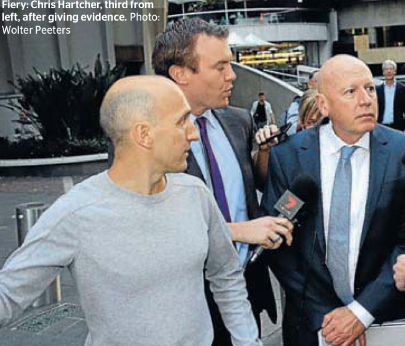
Harcher with skinhead (his son)

 The expensive legal teams engaged by politicians called before the ICAC inquiries advise them to reply "I do not recall" rather than make denials which could lead to charges of lying to the inquiry - Harcher used this response 35 times in giving testimony on Monday. But a different response was required when asked if he had pocketed $4000 from a cheque made out to the Liberal Party that had been laundered through his old law firms trust account as had been alleged by an employee in sworn testimony. Hence the new response "I resent that". More will be revealed when the inquiry resumes in August.


Baird would be taking a huge electoral gamble to proceed with a project that benefits no-one and inflicts irrecoverable damage on residents south of the Harbour.

Tuesday, 17 December 2013

A tale of two ghettos


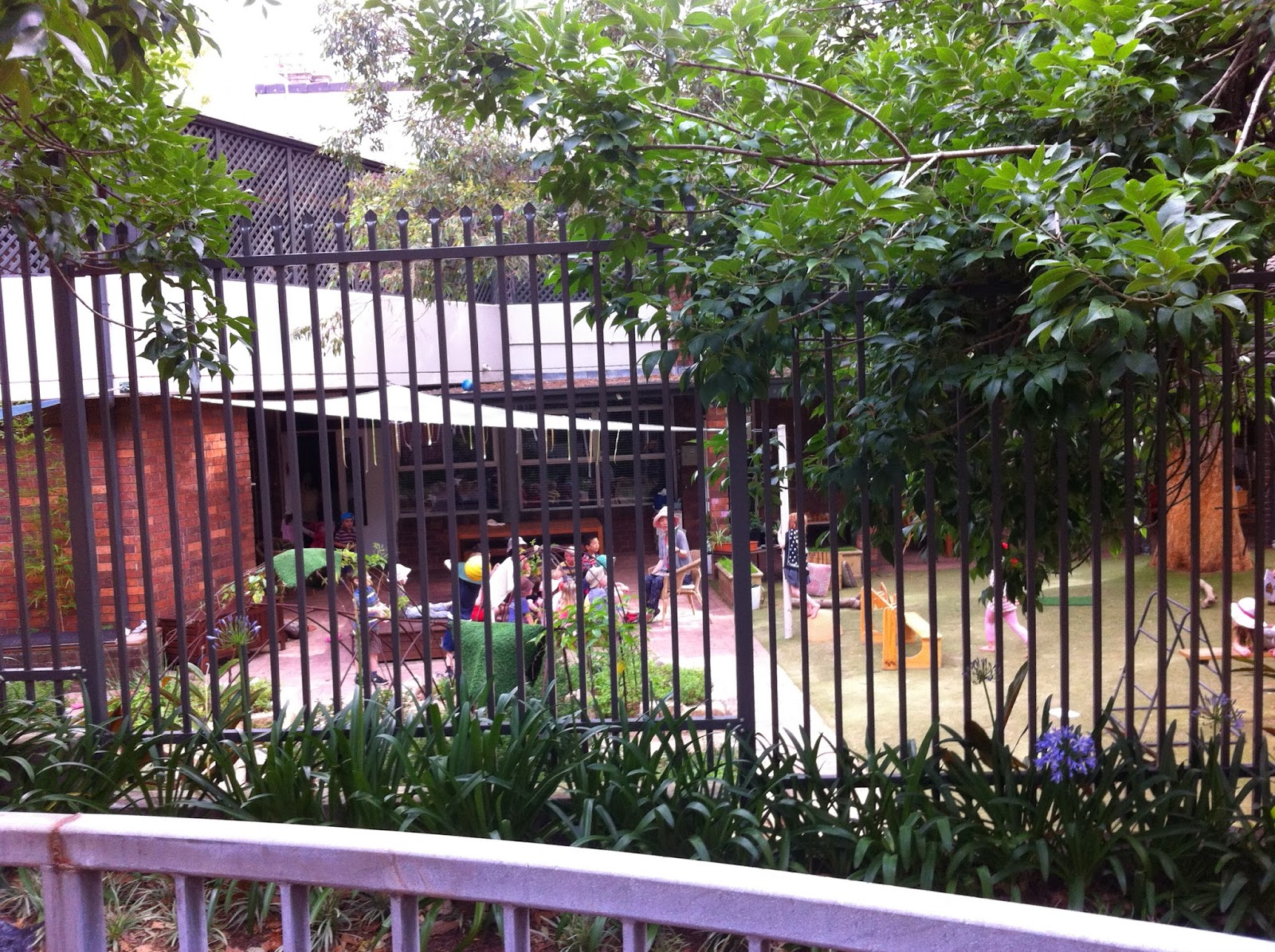
The SDN Children's Services is a not-for-profit organisation committed to providing high quality education and care for children 0-5 years of age, strengthening families, local communities and the children's services sector - to quote from their response to the discussion paper Statutory Child Protection in NSW. They have 22 centres in NSW, and the centre next to the Cooper Street Reserve has been established for yonks.

There is a high fence along the boundary with the Reserve to protect the children from adult predators. But nothing could protect them from the nastiest predator of them all, Barry O'Farrell, a serial stalker of preschools, primary schools and child minding centres.
The diagram left from Technical Paper 1 by Booz & Company is just one of the multiple choices for the intersection that TfNSW is asking to be approved. The yellow lines are presumably kerbs. I have no idea what the mauve dotted lines represent.

There is a large kerb blister on the corner occupied by the Madison Hotel. It is impossible to tell if it will be possible to turn from Chalmers Street into the single lane that is Devonshire Street or if traffic will be forced to use the right turn lane round the Telstra building feeding traffic into the western lane of Elizabeth Street. Either way traffic from the south will not be able to access Kippax or Cooper Street which have traditionally been the locale for the rag trade in NSW and for News Corp. There are now many more businesses in this area, in the advertising and media fields in particular.

Trucks and other vehicles needing access to this area will now have to turn into the single lane that Devonshire Street has been reduced to, and proceed east to Riley Street. The Cooper Street Reserve will be destroyed to allow rag-trade trucks and other vehicles to back track down Cooper Street. This is bizarre even by the standards of TfNSW.  Booz & Company proclaim this disingenuously: "To mitigate the impacts to local access the following changes are proposed to improve accessibility whilst maintaining the benefits to light rail operation:

  • Reinstate the Cooper Street connection to Riley Street to provide access for local residents"
In order to reach Riley Street, trucks and other vehicles have to pass Holt Street, the address of News Limited, and Waterloo Street which are wide streets that have been blocked off and would give direct access to Cooper and Kippax Streets. The reason they have been closed is to avoid trucks possibly "encroaching on the alignment of the light rail" when turning. The only concern of the O'Farrell government is avoiding any restriction on the speed at which cattle cars will be travelling when passing through Surry Hills.

A road connection through Cooper Street Reserve will be steep and difficult for trucks, as you can see from the photos, and it will not only be the only entry to this area of Surry Hills, between Devonshire Street and Foveaux Street, for traffic from the south - from Cleveland Street to Geelong - it will be the only entry for traffic from the Eastern Suburbs. They will need to make a right-hand turn from Riley Street.

O'Farrell is ghettoizing this section of Surry Hills as callously as he is ghettoizing the public housing sector. If the kids on early intervention programs at SDN have not been traumatised, they will be.

Monday, 9 December 2013

The joke of Butt

Clisdell Street in the Surry Hills ghetto
Clisdell Street has split carriageways with the southbound carriageway at a considerably lower level as you can see in the photos. They reach the same level only at the intersection with Devonshire Street.
Clisdell Street at intersection with Devonshire Street
 
This figure from Booz & Company Technical Paper 1 is impossible to read in the PDF. I had to go to the library to see the printed version and strain my eyes to make out the "Devonshire Place Making Initiatives". The red lines are Local Road Closures and the green areas are "local pocket park opportunities".

As you can see every major road accessing Devonshire Street except Elizabeth, Riley and Crown Streets have been closed. You have to wonder why have an eastbound lane at all? The text from Booz & Company titled Functional Changes says it all:

  • Closure of a number connecting streets (sic) at the intersection of Devonshire Street, including:
  1. Buckingham Street
  2. Holt Street
  3. Waterloo Street
  4. High Holborn Street
  5. Clisdell Street
  • No provision for parking provided along Devonshire Street
The blockage of Clisdell Street is south of a wide pedestrian path. Booz and Company state: "Pedestrians will benefit from improved amenity, particularly where streets are closed at their intersection with Devonshire Street as this presents an opportunity to increase footpath width".

"The closure treatments will need to provide appropriate turnaround facilities or service road access to adjacent streets".

You can see from the photos that it will be physically impossible to turn around from the lower carriageway to the upper. Which brings us to Butt Street.
Off-street parking from Butt St
 All the roads between Clisdell Street and Elizabeth Street are of course westbound with the exception of Butt Street where the direction is undefined. Butt Street is just a single lane at Elizabeth Street, so narrow the first floor balcony of the five story flats building has been damaged by turning trucks. It is an access lane to the off-street parking of the buildings fronting Elizabeth Street and Devonshire Street. TfNSW will be redefining it as the escape route from Clisdell Street. The southbound carriageway of Clisdell Street will be just waste space.
Belvoir Street Theatre
This will spell the death nell of the Belvoir Street theatre, across the southern end of Clisdell Street. The only vehicular access will be from Crown Street into Lansdowne Street - the only entry to the ghetto.

The other consultants refer lyrically to the Surry Hills stop as primarily servicing the local residential, dining and entertainment area, but few businesses will survive the tramway. It is a lot quicker to walk to these venues from the Devonshire Street tunnel exits of the Central rail platforms and from Elizabeth Street bus stops than from the proposed tram stop.

O'Farrell's only concern is with maximizing the profits of the private cattle car company, but he is killing the goose that lays the golden eggs.

Saturday, 7 December 2013

The planting strip

 
When Sydney Council installed yet another speed hump across the Crown Street bus route they placed planting strips at either end. The planting strip at one end was immediately removed as it was adjacent to outdoor seating of a cafe - Clover Moore spends rate-payers money like a drunken sailor. The other planting strip is crossed by well worn paths as you can see. The speed hump is close to the end of Reservoir Street which is the de facto preferred pedestrian path from Central to Taylor Square. I walk through this planting strip on a daily basis, sometimes several times a day.

It nearly proved the death of me this morning. Some motorists think the speed hump is a crossing and wave you through while traffic is not slowing down in the other direction. I ended up moving further down the road to cross where traffic does not slow down. Traffic is heavy in Crown Street on a Saturday morning. There is a signalised crossing in front of Crown Street Primary to the south but no one uses it.
There are planting strips on just about every second intersection in Surry Hills now and people walk through them as a matter of course.

The indicative plan for the Surry Hills stop shows a planting strip across the end of Riley Street. It even contains "existing trees", believe it or not. TfNSW insists this planting strip will force pedestrians along Riley Street to divert to signalised crossings at either end of platforms rather than walk directly across to the platforms and Ward Park. This will enable the coupled LRVs to pass through Surry Hills with priority signaling, at 50 kph or is that 60 kph, and nobody will get killed.

Other roads with pedestrian traffic such as Little Riley Street featured in the infamous artist's impression of the Shakespeare Hotel have no planting strips to dissuade pedestrians from crossing the at grade tram rails.

The EIS does not contain any data on what kind of emergency braking, if any, will be used on the LRVs, or the stopping distances that the LRVs will need.

What planet are the engineers at TfNSW living on?


Tuesday, 3 December 2013

By hook or by crook

There were three representatives from TfNSW at the Community Meeting organised by PUSH on Thursday 21 November. The Deputy Director General, Chris Lock, remains the total recluse he has been since the Randwick breakfast, but the American Jeff Gooding, appointed as project manager to "deliver the project" (his words) was there with deputies to explain the EIS process.
Jeff Goodling at Northcott centre
One of the deputies explained at great length that respondents should not comment on the Parramatta Light Rail but might want to comment on the right turn into Crown Street, raising the scorn of the audience.

The difficulty with making comments about this turn or any other turn at any other intersection in the system is that there is utterly no information in the EIS about these intersections. The Indicative plans of the stops have been cropped and there are no arrows on the lanes at intersections to give any indications of hook turns.

Corner of Devonshire and Crown Streets

The text in EIS Technical Paper 1 5.4.2.1 confirms that the left turn from Marlborough Street will be the only exit to the east and to the north from the ghetto. Every other street will be blocked off, including High Holborn Street in the picture left.

There is no information in the EIS on whether the right-turn lane will be a hook turn but why on earth would any one comment on it. The problems arise in Crown Street where there is no space for a right-turn lane into the ghetto. EIS works on the premise that if the tram lines do not pass though or past your property you have no right to complain.
Crown Street south from Devonshire Street
The Wentworth Courier in an article " Light rail to cause major disruptions" reported that the EIS reveals that access to St Peter's Catholic Church (next to High Holborn Street), the Langton Centre drug and alcohol rehabilitation facility, as well as the Twinkle Twinkle childcare centre would be "majorly limited". These properties and the Bourke Street Public School are directly adjacent to the rails.

The effects of the ghettoization of Surry Hills south of Devonshire Street will be far more wide spread. The section of Crown Street between Devonshire and Cleveland Streets is the retail hub of south Surry Hills and east Redfern, together with the shopping centre on the corner of Baptist and Cleveland Streets. There are two bus stops northbound and one southbound and there is short-term curbside parking. Crown Street is the only southbound road that accesses the same destinations as Chalmers Street, the sine qua non arterial for traffic from the south. If Chalmers Street becomes nothing more than a rat-run for really dumb rats, as TfNSW intends, Redfern Road, Baptist Street and Crown Street will have to deal with most of the displaced traffic. An enforced right-turn into Lansdowne Street will be the cause "major disruptions" to the businesses along these roads. Without a right-turn it will be the death nell for the Belvoir Street theatre.

Thursday, 28 November 2013

Culling the 20% - it is no joke

Cross section of Ward Park stop from EIS
I gave an account of the establishment of Ward Park and the Northcott housing development and the opening by Queen Elizabeth in an early post. Ward Park was the trade off for living in high rise apartments.

I could not sleep after the Community Forum at Sydney High School in April and wrote to the Minister for Transport the next day. One of the issues raised was the dangers to the public housing residents of trams running past this park. I referred to the closure of the exclusive bus roads in Moore Park for a couple of years following the death of a man hit by a bus late at night and the subsequent erection of the pedestrian barriers. I commented that NSW was the only place in the world that produced politicians insane enough to consider such a system.

As you can see the Minister was mortified and told her department to ensure the safety of public housing residents. The text states: "The stop would require the realignment of the pedestrian footpath adjacent to Ward Park to the south of the proposed stop". Children and dogs are depicted in the park  with just a step down to this footpath. The tram rails run effectively along the northern edge of the footpath and passengers will stroll across the rails to the central platform. The people shown teetering on the edge of the footpath, within touching distance of the trams, appear to be adults but could be children.

Within a couple of days after I posted the letter the news for residents got a lot worse. The Deputy Director General of TfNSW, Chris Lock, told a Randwich business breakfast that coupled cattle cars would shuffle between Chalmers Street and Moore Park, "back and forward, back and forward" and that these would be mixed with regular tram movements, which would presumably stop at the Ward Park stop. Nothing could save anyone who ran behind a stopped cattle car with one-way semi-transparent advertising into the path of a coupled juggernaut.

The so-called Technical Papers contain no information on how long it will take a "light rail" carriage to stop in an emergency. They are as technical as a prospectus for a tech-bubble internet startup company. The EIS is a continuation of the public relations campaign launched on 13 December, 2012.

When the Minister for Transport told the Community Forum in April that no change was possible she was reading from the script. The stop had to be in Ward Park so the rails could encroach on the Park and inbound Crown Street bus services could be looped through the ghetto. The only consideration was to cripple public bus services and maximise transferrals to privately operated cattle cars.
Ward Park - bus to tram transfer station
Marlborough Street looking south from Devonshire
The bus stop in Marlborough Street has, you guessed it, been cropped in Figure 5.34 so it is impossible to make any comments about it. The hook turn at Crown Street has also been cropped, so what can one say? About half of Ward Park will be used as a construction site, then its future as a bus to tram transfer station is completely undisclosed.

No representation made to the Minister or to TfNSW has had any effect on the plans drawn up in secret, without any feedback from independent appraisals.

However, the Minister was disingenuous when she said "no change is possible". She should have said the only change possible is a change of Government in NSW. Ultimately the voters in NSW will decide the future of the Australia's premier city.